
San Diego Drone Gallery
Drone footage from San Diego captures the region’s mix of coastline, canyons, and urban sprawl. Shot with the DJI Mini 4 Pro, these aerial views follow travel routes, hiking terrain, and Pacific waves along San Diego’s varied landscapes. From mountain ridges to surf zones, the images highlight moments of adventure from above.
Cowles Mountain


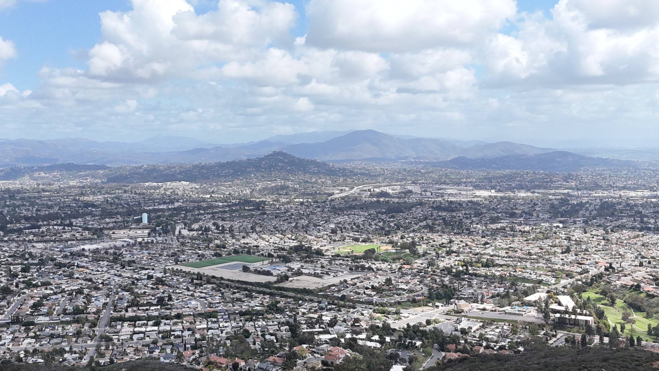
The highest point within the city limits of San Diego, Cowles Mountain rises above Mission Trails Regional Park with views stretching toward the Pacific. The exposed ridgeline and steep western slope are popular with hikers and trail runners. Drone coverage highlights the surrounding neighborhoods, layered hills, and inland terrain common across east San Diego County.
Ocean Beach

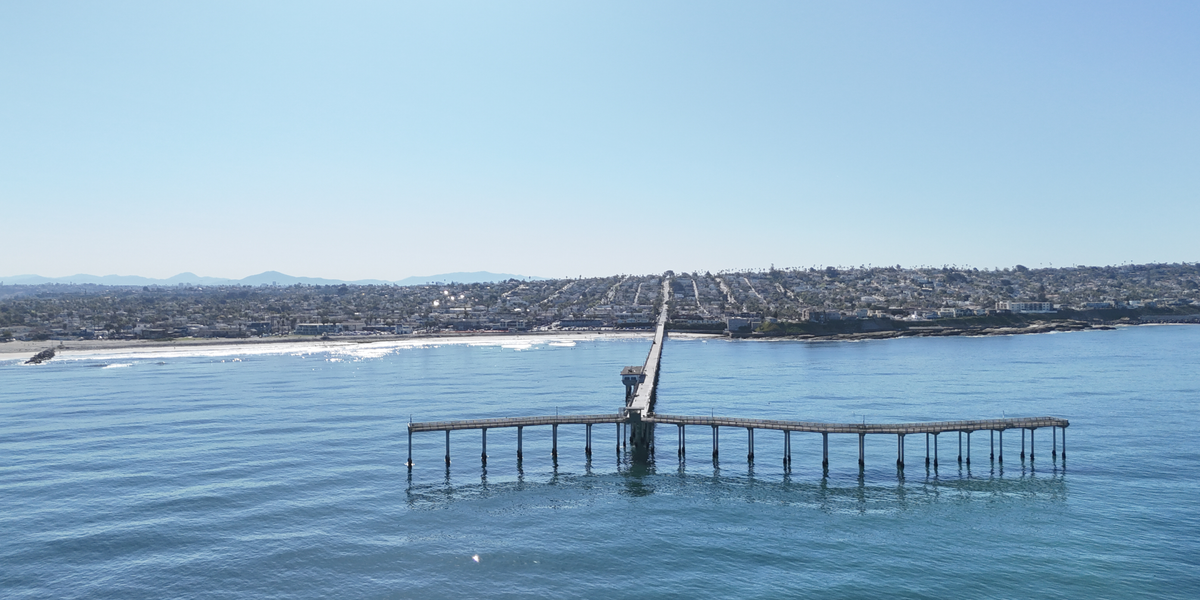

A compact beach community west of downtown San Diego, Ocean Beach is known for its pier, surf breaks, and tightly packed grid near the cliffs. Drone imagery captures the contrast between the ocean-facing homes and the open water, with wave patterns visible along the break zone.
Imperial Beach

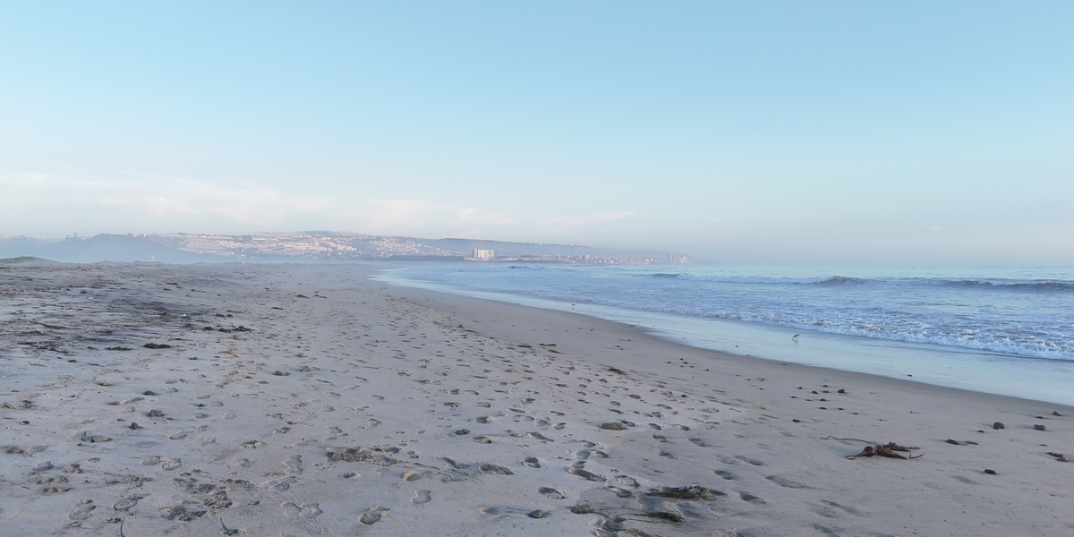

Located just north of the U.S.–Mexico border, Imperial Beach marks the southernmost stretch of California’s coastline. The shoreline is shaped by shifting sandbars and estuarine outflow from the Tijuana River. Coastal geometry, wave activity, and proximity to the border fence are prominent from above.
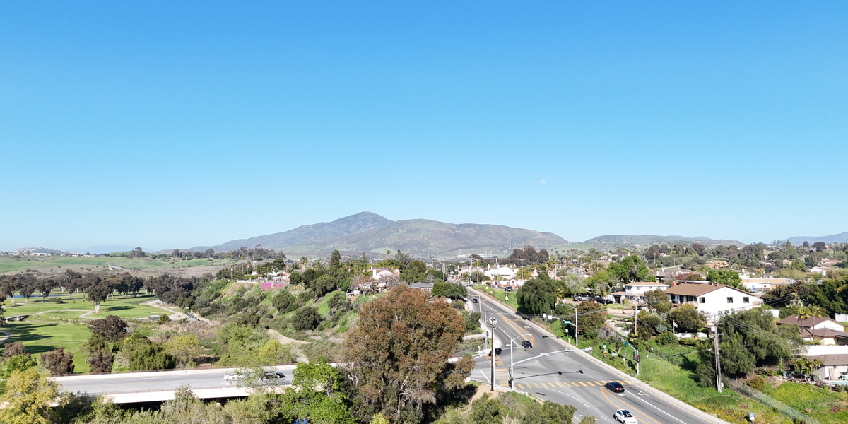
Santee


A suburban valley framed by rocky hills, Santee lies along the San Diego River between Mission Trails and the El Capitan corridor. Aerial views emphasize the grid layout, canyon edges, and dry terrain that defines this part of East County.
Chula Vista and Bonita


Chula Vista stretches from the bayfront inland toward foothills, while Bonita sits in a green belt along the Sweetwater River. Together, they show the transition from dense development to fragmented open space. Drone visuals highlight the river valley, reservoirs, and the residential sprawl along major corridors.
Mount San Miguel


Rising sharply above the South Bay suburbs, Mount San Miguel and nearby Mother Miguel Mountain are known for their antennas, switchbacks, and wide views of the border region. These summits stand apart from the coastal plain, offering clear sightlines across southern San Diego County.
Drone photography across Southern California offers a unique way to document terrain, infrastructure, and coastline—from the urban grid of Chula Vista to the cliffs of San Pedro and the inland trails of Cowles Mountain. Using the DJI Mini 4 Pro, each flight captures elements of the region that are difficult to access from the ground, making this gallery both a portfolio and geographic reference. Coverage spans beaches, mountains, and suburban landscapes throughout San Diego and Los Angeles counties, with content suited for travel, real estate, outdoor recreation, and land use projects.